- 05 Sep 2024
- 1 Minute to read
How to export results into Google Earth
- Updated on 05 Sep 2024
- 1 Minute to read
Exporting consequence and risk results from EFFECTS and RISKCURVES into dedicated GIS systems provides a dynamic visualisation of hazard zones and their impact on the surrounding environment. Here is a step-by-step guide on how to export consequence results into Google Earth.
Saving consequence contours
Ensure Google Earth Pro is installed: Before exporting, ensure that you have Google Earth Pro installed on your computer. If not, download and install the application from the official website.
Calculate the scenario: Complete the calculation of the scenario you wish to evaluate within your modelling software. Make sure to have the Map tab open to view the results.
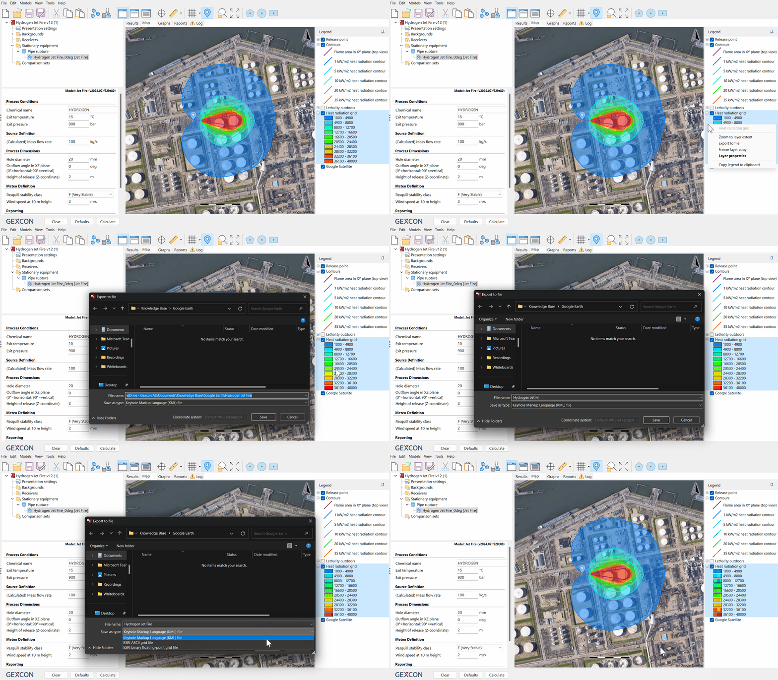
Export contours: Move the mouse cursor to the "Legend" section and hover over the information of the desired consequence contours. Right-click on the contour information and select "Export to file" from the context menu.
Save the KML file: Choose a relevant name for the file and specify the location where you want to save it. Ensure that the "Save as type" is set to "Keyhole Markup Language (KML) file," as Google Earth can read this file format. Click 'Save' to export the contours.

A demonstration on how to export contours to Google Earth.
Opening contours or grids in Google Earth
Locate the saved file: Navigate to the folder where you saved the exported KML file containing the consequence contours.
Open the KML File: Double-clicking on the KML file created will launch Google Earth.
View consequence results: Google Earth will display the consequence contours or grid on the map, centred around the location of your equipment. You can explore the contours from various angles and viewpoints using the navigation tools in Google Earth.
.JPG)
Image showing the exported contours from EFFECTS in Google Earth.
Conclusion
Exporting consequence results into Google Earth offers a powerful way to visualise hazard zones and their impact on the surrounding environment. By following these steps, you can seamlessly integrate your modelling data into Google Earth for a more comprehensive analysis and presentation of your findings.

