How to export a georeferenced map from a tile server
- 02 Aug 2024
- 1 Minute to read
How to export a georeferenced map from a tile server
- Updated on 02 Aug 2024
- 1 Minute to read
Article summary
Did you find this summary helpful?
Thank you for your feedback!
Using a tile server for background maps can be convenient, but reliance on an internet connection might not always be practical. In such cases, exporting a file-based image from a tile server provides a solution. This exported file is automatically georeferenced, allowing offline usage and integration with other GIS tools. Here is how to do it:
Steps for exporting
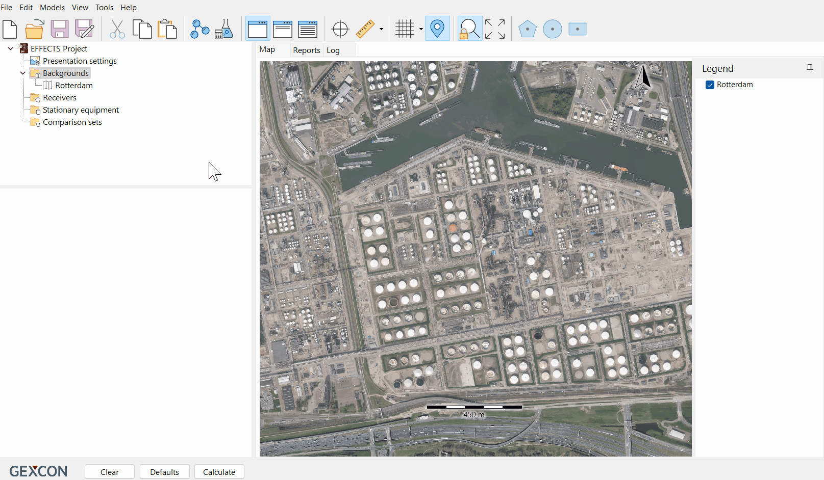
Add tile server: Right-click on "Backgrounds" in the project tree and select "Add tile server".
Select tile server: Choose the desired tile server from the "Preset" drop-downA list.
Navigate and zoom: Zoom in to locate your facility on the map (scrolling in with the mouse or drawing a square from the top-left corner to the bottom-right corner).
Lock zoom: Lock the zoom using the "Lock" function available in the Menu bar.
Export image: Right-click on any point on the map and navigate to "Export" > "Export to file".
Save settings: Select the folder you would like to save the file in and ensure the file format is set to "Image file" (e.g. PNG).
Save file: Provide a name for the georeferenced map and save it.
Using the georeferenced map
Once you have exported the georeferenced map, you can easily add it to your project:
Add background map: Right-click on "Backgrounds" in the project tree and select "Add background map".
Select file: Navigate to the folder where you saved the georeferenced map and click 'Open'.
Import details: The "Import a background map" window will display the georeferenced details of your map, already populated.
Confirmation: Click "OK" to load the map.
Checking georeferencing accuracy
To ensure the accuracy of the georeferenced background map, you can use different tile servers- to check whether the images overlap.
Add tile server: Add a tile server, by right-clicking "Backgrounds" in the project tree.
Select tile server: Select the desired tile server from the "Preset" drop-down list.
Zoom out: Zoom out on the map to view a wider area.
Comparison: Check that the objects on the edge of your background map align with the objects on the tile server to verify the georeferencing accuracy.
By following these steps, you can seamlessly export, utilize, and validate georeferenced background maps from tile servers in your projects.
Was this article helpful?